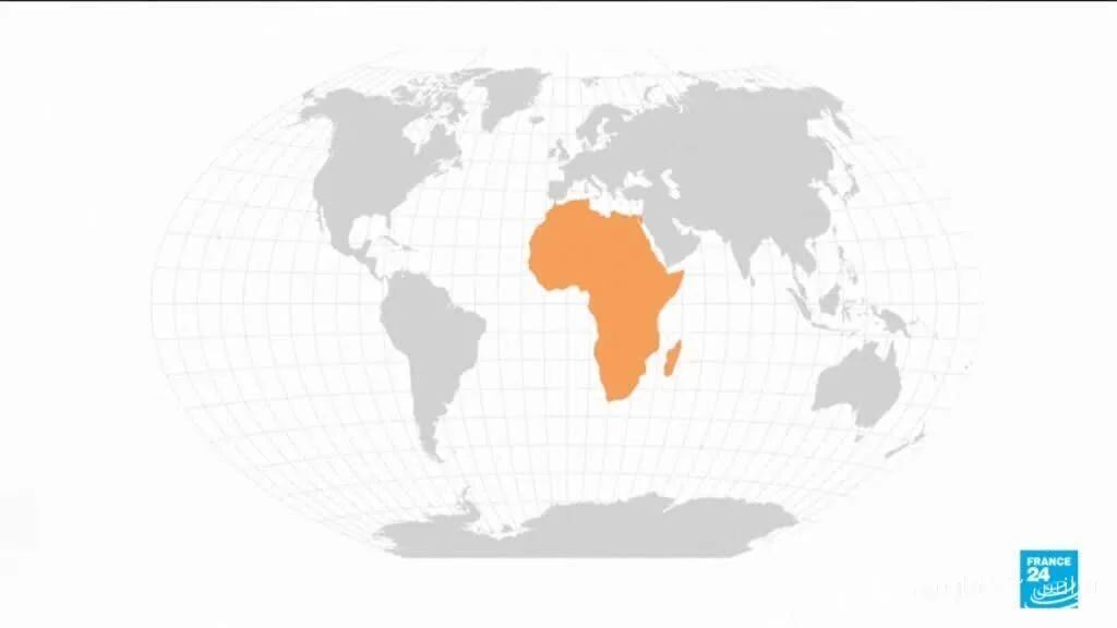
Last Friday, the United Nations, by adopting a historic resolution, voted to change the global map pattern from the Mercator map of the ۱۶th century to a map that displays the true dimensions of the countries of the African continent. This resolution, following the efforts of African countries, aims to counter misconceptions about the marginalization of this continent.
The Mercator Map and Its Challenges
The Mercator map, which has been used as the global standard for centuries, has been heavily criticized for exaggerating northern countries and minimizing southern countries. This issue is particularly significant regarding Africa, which appears significantly smaller than what is shown on this map. Many experts believe that this type of representation leads to a misunderstanding of the power and geographical position of the African continent and contributes to the perpetuation of colonial and racist views.
Cultural and Economic Impacts
The adoption of this resolution not only represents a symbolic victory for African countries but can also have profound effects on the global understanding of Africa and its place in the international community. This change can help raise public awareness about the culture, history, and economic capabilities of the African continent and, on the other hand, allows countries to present a more accurate image of themselves to the world.
The new map can also help African countries be recognized as independent and significant nations in international negotiations and economic collaborations. This action is part of broader efforts aimed at changing misleading narratives and improving the image of the African continent on a global scale.